

ENVIRONMENTAL
The environmental sector is contending with challenges that extend from immediate threats, like acute pollution events and extreme weather, to long-term systemic issues including climate change, biodiversity loss, and sustainable resource management. These issues are profoundly interconnected, threatening the ecosystems we rely upon and impacting economic stability. The more we develop as a society and expand our infrastructure, the greater the pressure that is put on the environment that we interact with and on those that need to understand what changes are happening and plan for the future.
Akin to analysing weather and climate, understanding how physical natural systems change over time requires more than observation, it demands precise and repeatable data that can be analysed and compared across years or even decades. J C White Geomatics Ltd. supports environmental professionals by delivering surveys that capture the complexity of landscapes, habitats, and ecosystems. From UAV‑based LiDAR to traditional surveying, our methods provide the insight needed to balance development with ecological preservation. By tailoring survey strategies to the unique requirements of each project, we help organisations monitor fragile environments, quantify impacts, and gather information on current conditions to plan interventions that are both effective and sustainable.
We have long been recognised for embracing new technologies and applying them across disciplines. This forward‑thinking approach allows us to design survey programmes that not only meet immediate project needs but also contribute to broader research in climate modelling, conservation, and sustainable urban planning. Our clients benefit from data that is technically robust, but also presented in ways that make it accessible to decision‑makers, researchers, and planners. In this way, surveying becomes a bridge between science and policy, enabling informed choices that protect ecosystems while supporting responsible development.

Integrate our precision.
Get in touch with us to discuss how our years of geospatial observations and mapping can help your environmental project.
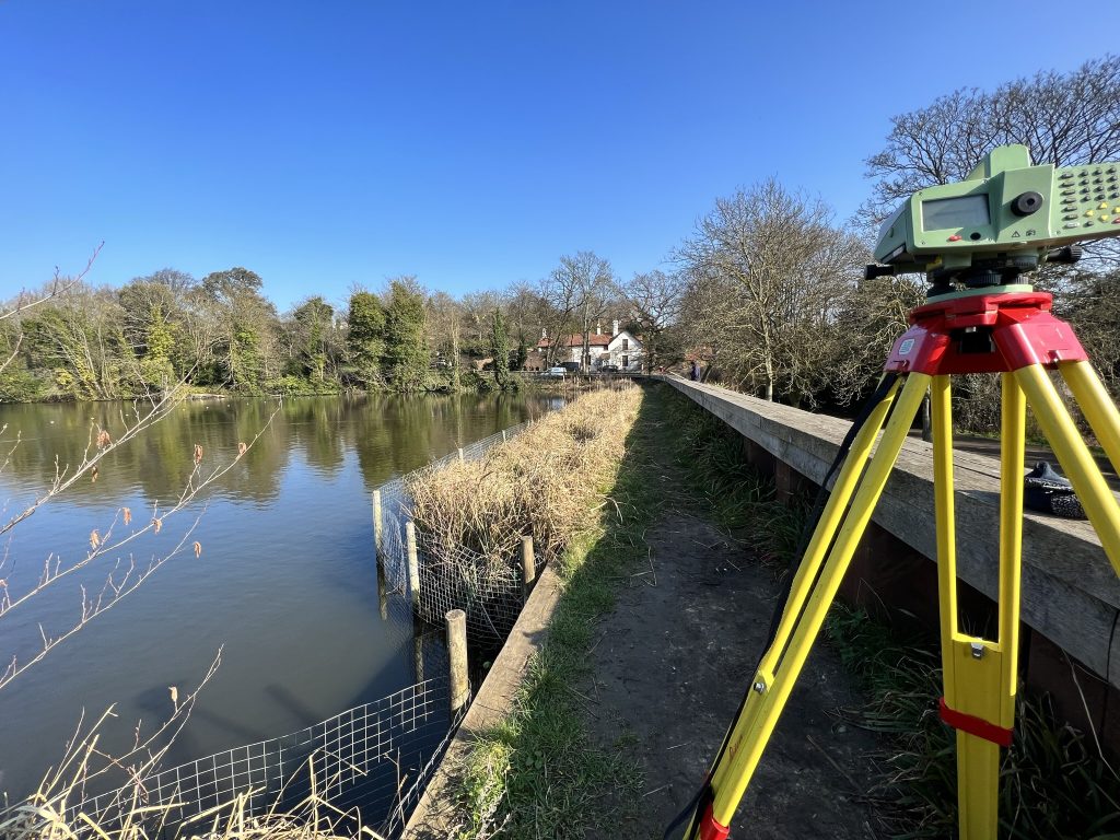


J C White Geomatics Ltd. equips environmental professionals with the tools required to address pressing ecological challenges. Our ability to capture and deliver highly accurate geospatial data supports sustainable resource management, conservation planning, and climate resilience. By combining advanced technologies with proven methodologies, we provide the insight needed to monitor ecosystems, mitigate risks, and protect natural resources. The following examples highlight how our services contribute directly to conservation and sustainability:
- Accurate Land Use and Habitat Mapping. Environmental management relies heavily on up-to-date maps of land use. Precise boundary delineation and detailed mapping of ecosystems help identify critical habitats, protected areas, and zones of ecological fragility. This kind of spatial accuracy is crucial for effective conservation planning and mitigating human impact on biodiversity by increasing the precision and repeatability of data sets,
- Monitoring Land Cover Changes. Rapid urbanisation, agricultural expansion, and other land cover changes often lead to deforestation and habitat fragmentation. Land surveying monitoring techniques, including remote sensing, conventional levelling, and UAV mapping, enable environmental scientists to monitor these changes reliably and repeatably,
- Flood Risk and Water Resource Management. As climate change intensifies, patterns of precipitation and extreme weather events are shifting. High-precision topographical surveys are indispensable in mapping flood plains, identifying natural drainage patterns, and designing effective flood defences. Accurate surveys also support sustainable water resource management by delineating watersheds and determining water flow dynamics,
- Assessing Erosion and Land Degradation. Erosion, largely caused by unsustainable agricultural practices, deforestation, and coastal forces, poses a significant environmental threat. We can create erosion models and help identify vulnerable areas, tracking patterns over years either at fixed points or across a whole stretch of banking. By monitoring changes in terrain and land stability over time, our surveys enable environmental agencies to design schemes based on the most up-to-date mapping detailing land conditions,
- Environmental Impact Assessments (EIAs) and Land Development. Before any construction or infrastructural project begins, understanding the environmental implications is paramount. Land surveys provide foundational data for EIAs, ensuring that construction projects are placed carefully to minimise disruption to sensitive ecosystems. This includes accurately mapping topographic features and creates a platform for ecological mapping to be located on for pin-point quantification, helping development projects through their Assessments,
- Disaster Management and Post-Event Recovery. Natural disasters such as wildfires, floods, or landslides can dramatically alter landscapes. Detailed surveys in at-risk areas enable authorities to assess damage quickly and accurately. This information is vital for planning recovery efforts and for future urban planning to mitigate similar disasters.
Looking Ahead: The Future of Environmental Surveying
The future of land surveying is moving toward a far more integrated, data‑rich discipline, one that blends traditional field expertise with advanced technologies like UAV photogrammetry, LiDAR mapping, and automated geospatial analytics. As these tools become more precise and more accessible, surveyors will be able to interpret dynamic environmental systems in real time. That evolution positions the profession as a critical bridge between raw geospatial data and actionable environmental insight.
This shift will reshape how the environmental sector approaches challenges such as erosion modelling, landfill monitoring, embankment stability, and coastal change detection. High‑frequency, high‑resolution datasets will allow environmental teams to predict issues earlier, intervene more precisely, and justify decisions with defensible evidence. As climate pressures intensify, the demand for continuous, technology‑driven monitoring will only grow, making land surveyors indispensable to sustainable planning and risk mitigation.
– Joe Smith, Director
